Sejour package
Tour of the valley of Névache - L'Échaillon
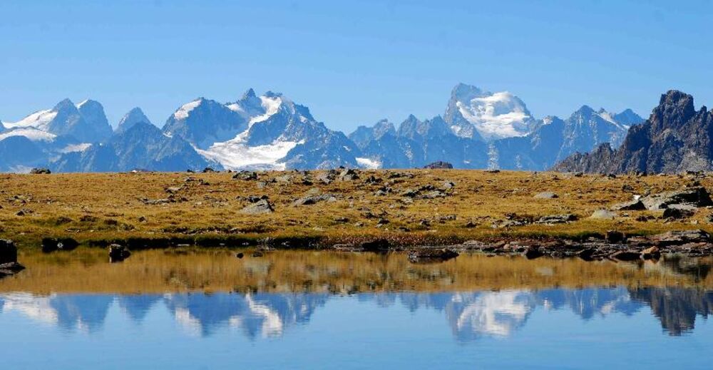
La Clarée takes its source on the heights of Névache and its valley is a paradise. We are in the Hautes-Alpes not far from Briançon where the sun shines in a deep blue sky, where fauna and flora plant an admirable scenery.
Sejour package
Tour of the valley of Névache - L'Échaillon
The old summer hamlets, chapels and sundials will tell you the history of the country. The trails will lead you, on each side of the river: from Côte Rouge to the Chemin de ronde, from the Vallon des Muandes to the Vallon des Thures, but also near the lakes Laramon, Serpent, Long, Rond... from where you will have a breathtaking view of the Ecrins, the Meije or the Thabor.
PROGRAM
Day 01 – Sunday: Nevache – Lakes Laramon and Serpent – refuge Ricou
Meet at 9:00 am at the hotel l'Echaillon in Névache (1600m), where you can park your car for the week. We leave directly to
foot to go up along the Clarée. We can picnic at the waterfall of Fontcouverte before continuing to the refuge Ricou and
the lakes that overlook it, the famous Laramon lake (2359m) and Serpent lake (2448m). Valley classics with a panorama
beautiful. Night at the Ricou refuge (2115m).
850 m - 450 m - 6:00 AM walk
Day 02 – Monday: Cula and Muandes lakes
We reach the valley of the Cula to find one of the favorite lakes of fishermen at 2450m altitude, which offers a magnificent point of
view of the Cerces. We continue on the patrol road to switch to the valley of Muandes by an off-trail route. We
Enjoy the vast and peaceful alpine pastures of the Muandes where we climb to discover a series of lakes. Overnight at the refuge de Laval (2030m),
700 m - 800 m - 6:00 walk
Day 03 – Tuesday: Lac and Col des Béraudes – Cols de la Ponsonnière and des Cerces
A beautiful day of walking, on trails of varied terrain, to the rhythm of the passes and lakes: the tour of Cerces, by the Béraudes. We
First we climb through the melezine then in alpine pasture to reach the famous lake of Béraudes (2504 m), with turquoise water. By a long
uphill crossing in stony, we head towards the passage of the Col des Béraudes (2770 m), a little dizzying but where the summits
of Ecrins welcome us. We then reach the Col de la Ponsonnière (2613 m) which marks the entrance to Savoie. We descend towards
the Lac des Cerces, then a final climb takes us to the pass of the same name (2574 m). On the descent, three lakes still reserve their
favours, before following the first kilometres of the tumultuous Clarée trail to the Laval refuge.
1000 1000 m - 7 to 7h30 walk
Day 04 – Wednesday: Vallon du Chardonnet – Lacs de la Casse Blanche
We go along the Clarée to descend back to the hamlet of Rif Tord. Then we climb to that of Queyrellin
plateau where the shelter is located (2227m), and where we can lighten the bags. Then we can explore the area of the Casse Blanche to
find its 2 lakes, before returning to the Col du Chardonnet and its view of the Ecrins. Return to the refuge for the night.
800 600 m - 6:00 walk
Day 05 – Thursday: Col de Roche Noire – Col et refuge de Buffère
Through the calm and wild valley of the Raisin, we reach the col de Roche Noire (2693 m) which makes us swing in the valley of the
verdant de la Moulette. We then follow a good path in balcony - «the feel of climbers» -, overlooking the Guisane valley,
its alpine domain of Serre-Chevalier and the city of Briançon), with a beautiful view of the Ecrins. The col de Buffère (2427 m) brings us back in
Clarée, to go down in the valley towards the refuge of the same name. Possible option of the ascent of the Grand Area (2869m, 450m and 2h of
more). Overnight at the refuge of Buffère (2076m).
650 m 1250 m 6h00 walk
Day 06 – Friday: Red Coastal Trail – Lakes Cristol and Oule-Névache
Departure for the nearby valley of Cristol by the path in balcony of red coast, to go to the large lake (2250m). By a small pass without name
(2516m), we tip in the next valley, the valley of Oule. Possibility to make the small summit of the Pic de Longet (2573m) before
back down to the lakes and the village.
Dispersal planned around 16:00. 650 m 5h30 walk
Course of your stay
The elevation differences and times given do not include options. This route is the “frame” of your hike. Each of our guides tries to offer you a “plus” on this hike: a summit, a detour to surprise chamois, partridges, marmots... a magnificent fossil, lily of the valley.
We may sometimes have to change the indicated itinerary: either at the level of the organization (problem of overloading accommodation, duplication of groups, modification of the state of the terrain, etc.), or directly due to the accompanying person (weather, group level, etc.). Trust us, these changes are always made in your interest, for your safety and better comfort!